Ground-based remote sensing of the urban boundary layer (UBL)
Ground-based remote sensing is used to study the urban boundary layer, in particular for measuring profiles of air temperature, humidity, aerosols, wind speed and wind direction as well as for recording clouds and precipitation.
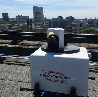
Doppler LiDAR Systems
The UCO Berlin has two Doppler LiDAR systems (Streamline XR by Halo Photonics). The scanner unit enables complex scan patterns in the upper hemisphere. The measurement systems provide profiles of the backscatter intensity of aerosols and clouds, the Doppler velocity and, derived from this, profiles of the horizontal wind speed and wind direction as well as information on atmospheric turbulence.
The figure on the right shows a vertical profile (up to 3 km altitude) of wind speed and direction for 24 hours on a summer's day. At night, a speed maximum can be seen, which is referred to as a low level jet.
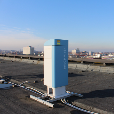
Ceilometers
Cloud height, cloud cover and aerosol layers are recorded with ceilometers (CHM 15k by Lufft) at the sites Grunewald and TUB Campus Charlottenburg which are part of the
E-Profile Network of the European meteorological services EUMETNET. The CHM 15k uses the LiDAR method (Light Detection And Ranging), i.e. short light pulses with a wavelength of 1064 nm are emitted into the atmosphere, where they are scattered by aerosols, droplets and air molecules. The reflected part of the light that hits the ceilometer is analyzed further. The range is 15 km, the vertical resolution of the processed data is 15 m and the temporal resolution is 15 s. Data at TU Campus Charlottenburg can be viewed
here.
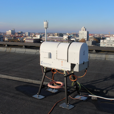
Microwave radiometer
A microwave radiometer (HATPRO-G5 by RPG Radiometer Physics GmbH) provides vertical profiles of air temperature and absolute humidity up to an altitude of 10 km. These profiles as well as the integrated liquid water path (LWP) and the integrated water vapor (IWV) are derived from measurements of the radiation temperature in 14 channels, i.e. seven frequencies between 22.24 and 31.4 GHz (K-band; water vapor band) and seven frequencies along the oxygen complex between 51 and 58 GHz (V-band; oxygen band).
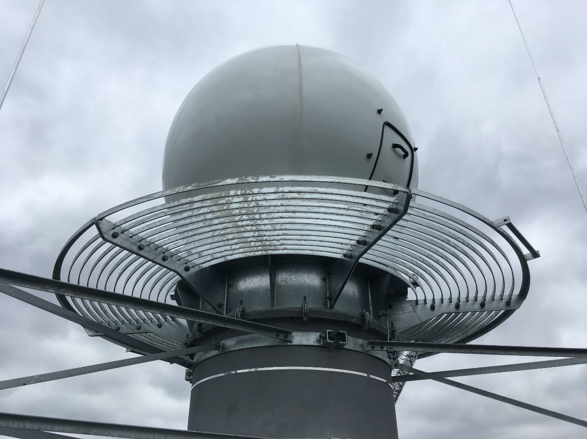
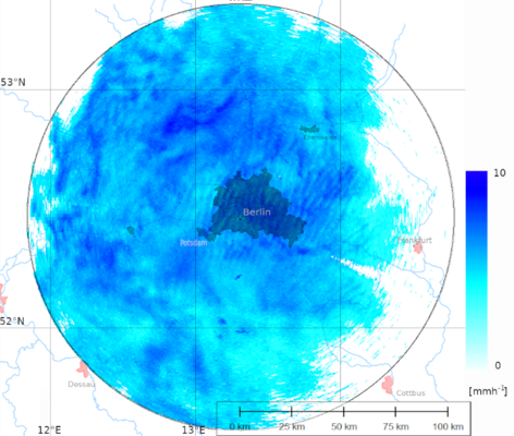
X-Band Doppler weather radar
An X-band Doppler weather radar with dual polarization (GMWR-25-DP by GAMIC) for precipitation research has been in operation since the end of 2022. The weather radar is installed on the roof of the water tower on the Fichtenberg in Steglitz. The tower belongs to the Institute of Meteorology at the FU Berlin, which operates the radar together with the Department of Climatology (TU Berlin). It has a range of 100 km.
Live images of the weather radar can be seen
here. These images show the measured reflectivity, i.e. the electromagnetic radiation reflected by hydrometeors (water droplets, snow crystals, hail and sleet grains) at 9410 MHz. The weather radar performs a volume scan with seven elevations and an RHI scan in the direction of the TU Charlottenburg campus within 5 minutes. The live images show the 360 degree scan at an elevation of 1 degree.