Urban Climate Observation Network (UCON)
The UCON provides ground-level measurements of atmospheric variables. Air temperature and relative humidity are measured at all locations and in some cases air pressure, global radiation, wind speed and wind direction as well as precipitation are also recorded. These measurements take place between within built-up and vegetated areas, i.e. in the so-called urban canopy layer (UCL).
Since the 1990s, automatic weather stations (AWS) have been used for this purpose, providing hourly or higher resolution data. Including the measuring stations of the German Weather Service (DWD), it is thus possible for the first time to carry out dedicated analyses of a 30-year normal period for urban and non-urban locations. Detailed descriptions of the locations as well as analyses of the urban heat island and the spatial and temporal variability of air temperature can be found in Fenner et al. 2014.
The figure below shows the distribution of the long-term stations of the UCON. The data can be found and downloaded in the Data Portal.
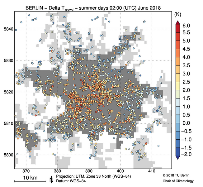
Since 2015, data has been systematically collected from private Netatmo weather stations in Berlin and the surrounding area (crowdsourcing). Specially developed quality assurance methods enable new approaches to researching the urban climate with the help of these citizen weather stations (Meier et al. 2017, Napoly et al. 2018). The figure below shows the mean difference between the night-time air temperature (02:00 UTC) and the 25% percentile of all rural CWS in June 2018 for summer days (Tmax > 25 °C) for 1936 quality-checked Citizen Weather Stations (CWS).
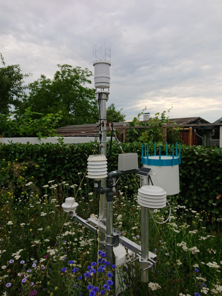
Further weather stations, including for recording precipitation, were temporarily installed in 2022 as part of the citizen science project OpenUCO, particularly in allotment gardens. The photo below shows the UCON station in an allotment garden colony in Berlin-Charlottenburg.